History · Ch 3 — Nomadic Empires
Social and Political Background
Social and Political Background
The Mongols were never a single, uniform people. They were a diverse body of groups bound together by language, with ties stretching east to the Tatars, Khitan and Manchus, and west to the Turkic tribes. Within this broad family, two distinct ways of life existed: pastoralism and hunting-gathering.
The pastoralists were the more prominent group. They herded horses and sheep primarily, with cattle, goats and camels playing a lesser role. Their world was the Central Asian steppe, in the region of the modern state of Mongolia. It was a majestic landscape of wide horizons and rolling plains, ringed by the snow-capped Altai mountains to the west and the arid Gobi desert to the south. The Onon and Selenga rivers, along with countless springs fed by melting snow from the northern and western hills, drained the land. In a good season, the region offered lush pasture and considerable small game.
Drawn by us to help you understand the concept clearly, and verified to make sure it's accurate. For exams, practice from your NCERT textbook's own diagram.
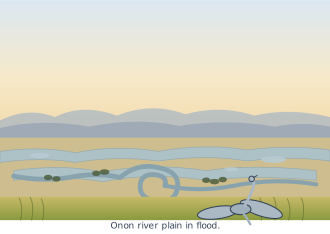
The photograph shows the Onon river plain in flood, a wide landscape shot taken from some elevation. A winding river channel cuts through the foreground and middle distance, its water swollen and spread beyond its normal banks. The plain itself is covered in golden-green steppe grass, the colour suggesting late summer or early autumn pasture. Low, hazy hills close the horizon, softening the skyline. There are no people, animals, tents or structures in the frame — the image is purely of the land and the river.
What makes this figure worth pausing on is what it grounds in the text. The Onon is one of the two rivers named as draining the Mongol homeland, along with the Selenga. The description of the region as a "majestic landscape with wide horizons, rolling plains" is exactly what the photograph shows: an open, treeless expanse where the eye travels far before meeting any obstruction. The flood itself is significant. The text stresses that pasture depended on a good season, and that drought could parch the grasslands and drive families into conflict. A river in flood is the opposite extreme — an abundance of water, but water that has temporarily made the low-lying pasture unusable. So the image quietly illustrates the precariousness at the heart of nomadic life: the same landscape that could sustain herds in a good year could also, through flood or drought, force movement, raiding, and alliance. …
The hunter-gatherers lived a humbler existence to the north, in the Siberian forests beyond the Onon river plain. They survived by trapping animals in the summer months and trading the furs they collected.
The entire region suffered from extremes of temperature — harsh, long winters followed by brief, dry summers. Agriculture was possible in the pastoral regions for short parts of the year, but the Mongols, unlike some of the Turks further west, never took to farming. Neither the pastoral nor the hunting-gathering economy could sustain dense populations, and so the region had no cities. The Mongols lived in tents called gers, moving with their herds between winter and summer pastures.
Ethnic and language ties united the Mongol people, but scarce resources shaped their society in a very specific way. Society was divided into patrilineal lineages. The richer families were larger, owned more animals and pasture land, and therefore attracted more followers and wielded greater influence in local politics.
Periodic natural calamities — unusually harsh winters that exhausted game and stored provisions, or droughts that parched the grasslands — would force families to forage further afield. This led to conflict over pasture lands and predatory raids in search of livestock. Groups of families would occasionally ally around richer, more powerful lineages for offensive and defensive purposes, but these confederacies were usually small and short-lived.
The scale of Genghis Khan's confederation of Mongol and Turkish tribes was perhaps matched only by the one Attila had stitched together in the fifth century. But there was a crucial difference. Attila's system died with him; Genghis Khan's political system was far more durable and survived its founder. It proved stable enough to counter larger armies with superior equipment in China, Iran and eastern Europe. As the Mongols established control over these regions, they found themselves administering complex agrarian economies and urban settlements — sedentary societies quite distant from their own social experience and habitat.
Yet the nomadic and agrarian worlds were hardly foreign to each other. The scant resources of the steppe drove the Mongols and other Central Asian nomads to trade and barter with their sedentary neighbours in China. This was mutually beneficial: agricultural produce and iron utensils from China were exchanged for horses, furs and game from the steppe.
Commerce, however, was never free of tension. Both groups unhesitatingly applied military pressure to enhance profit. When the Mongol lineages allied, they could force their Chinese neighbours to offer better terms, and trade ties were sometimes discarded in favour of outright plunder. When the Mongols were in disarray, the Chinese would confidently assert their influence in the steppe. …
Listed below are some of the great Central Asian steppe confederacies of the Turks and Mongol people. They did not all occupy the same region and were not equally large and complex in their internal organisation. They had a considerable impact on the history of the nomadic population but their impact on China and the adjoining regions varied.
| Confederacy | Approx. date | People |
|---|---|---|
| Hsiung-nu | 200 BCE | Turks |
| Juan-juan | 400 CE | Mongols |
| Epthalite Huns | 400 CE | Mongols |
Drawn by us to help you understand the concept clearly, and verified to make sure it's accurate. For exams, practice from your NCERT textbook's own diagram.
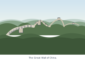
The photograph shows the Great Wall of China snaking over forested mountain ridges, its grey stone surface cutting a clear line through the green. In the foreground, the wall is paved and battlemented — a walkway wide enough for guards to patrol — with a watchtower rising at intervals. The towers are solid, square-built structures, the kind that housed soldiers and stored signals. Beyond the immediate wall, ridge after ridge recedes into the distance, each one carrying its own stretch of fortification, until the line of the Wall fades into the haze.
What the image captures is not a single monument but a system. The Wall was never one continuous structure built at one time; it was a series of walls, ramparts and watchtowers raised by different Chinese dynasties, gradually linked from the third century BCE onward into a common defensive outwork. The watchtowers in the photograph are the key to understanding its function — they were lookout posts and signal stations, allowing fire and smoke warnings to travel quickly along the frontier. The paved walkway on top let troops move along the wall to reinforce a threatened point. The Wall did not stop nomads by sheer height alone; it slowed them, channelled their raids, and gave the settled Chinese armies time to respond. …